 |
| |
| |
| |
| |
| |
| |
| |
| |
follow us on: |
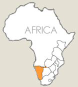
 NAMIBIA SAFARI VACATION GUIDE AND TRAVEL INFORMATION |
||||||||||||||||||||||
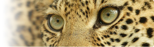
A place where undulating deserts fold down to meet a tempestuous coastline, Namibia offers a diverse range of highlights: Scenic beauty including the Skeleton Coast – untouched and untamed, home to the rare Brown Hyena and Desert Elephants, seal colonies; the Kunene River – the source of one of Africa’s greatest waterfalls, the Ruacana; the splendour of abundant bird and wildlife; unusual geological formations including Fish River Canyon, Brandberg, Spitzkoppe and the unique dune mountains at Sossusvlei; pristine wilderness including Etosha National Park, the Namib Desert; the diverse and friendly nation and adventure opportunities – from sand boarding, canoeing, white water rafting to hot air ballooning. more>>> MAP OF NAMIBIA
Windhoek · Waterberg · Etosha National Park · Damaraland · Twyfelfontein · Cape Cross · Seal Colony · Welwitschia Mirabillis · Namib Desert · Sossusvlei · Sesriem Canyon · Naukluft · Fish River Canyon · Skeleton Coast Windhoek: The capital of Namibia lies at an altitude of 1603m and has a population of 150 000. The name of the city can be traced back to Chief Jonker Afrikaaner. The mountains around Windhoek reminded him of the farm Winterhoek near Tulbagh in the Cape (South Africa). Waterberg: The Waterberg is the relic of a sandstone layer which once covered a substantial part of Namibia. The sandstone was eroded away, leaving only fragments scattered over the plain like pieces of a jigsaw puzzle on the floor of a child’s playroom. The Waterberg remnant of this lost landscape is a flat-topped plateau 48km long and between 8 and 16km wide. Etosha National Park: Its name derives from the Ovambo e Tosha and conserves 22 270km2 of semi-arid savannah, including the pan itself. The pan temporarily fills with water during wetter summers, attracting breeding flamingos, pelicans and other waterbirds. The more common mammals are springbok, blue wildebeest, gemsbok, red hartebeest, greater kudu, giraffe, steenbok, black faced impala, and the Damara race of Kirk’s dik-dik. Following large scale hunting by European hunters, the first German governor Von François introduced hunting laws and made hunting permits obligatory. In 1907 Governor von Lindequist declared one fourth of South West Africa a nature reserve. The Etosha Pan and the surrounding area were included. The fauna regenerated rapidly. The Kaokoland was incorporated into Etosha making it one of the largest reserves in the world. The Odendaal Plan based on the homeland policy of South Africa removed Kaokoland from Etosha in 1972. The Park is entirely fenced similar to the South African parks; Kruger, Zululand etc. Namutoni: The fort was built by the Germans as a police post in 1903. A Silesian nobleman Count Wilhelm von Saurma Jettsch had the idea of a gleaming white fort in the wilderness. The count designed the fort as an irregular quadrangle, 60m x 68m, with four towers and three gates. Accommodation for officers and men was provided inside. There was a kitchen, a cool room for provisions, some sheds, a bakery, smithy, gunsmith’s workshop, joinery, wheelwright, and even a swimming-bath outside of the fort. On 6 July 1915, Namutoni was occupied by South African troops after the Germans were defeated. From then on, the fort was only occupied occasionally and gradually became dilapidated. The fort was declared a historical monument in 1950 and funds were allocated by the government to rehabilitate it and to convert it into a tourist camp. In 1957 the reconstructed building was opened to tourists who were mainly local residents from Windhoek. Sunset at the tower is a superb spectacle of colour over the endless savannah plains. Halali: The most recent camp in Etosha. The name is derived from the bugle call made by the German soldiers. Okaukuejo: (Watering place of the lion) is the headquarters of the park and the first and largest tourist camp built in Etosha. Damaraland: The Odendaal plan had envisaged homelands for the various indigenous population groups, including the Damara. The Damara probably originate from the Sudan, and they knew how to melt iron and copper and to forge metal. They made spearheads and axes for the Herero and Hottentots. The most serious problem encountered in Damaraland is the lack of water. Dryland farming cannot be practised due to the poor quality of the soil and the low rainfall. Khorixas - the main town of Damaraland - was formerly known as Welwitschia. Twyfelfontein: The valley is known in the Damara language as Uais (one fountain). When it flows, this fountain has attracted game animals and man. Since its nature has always been erratic, Europeans have named it Twyfelfontein (the doubtful fountain). The origin of the well preserved rock engraving is uncertain. They are probably the work of Bushmen or Nama artists and are estimated by some to be about 5000 years old. Engraving on rocks is difficult, with no possibility of erasing errors. The engravings are so skillfully done that they must have been the work of artists who have previously learnt the skill on waste rock and who had made no amateurish mistakes. Cape Cross: Diego Cao erected a padrao (cross) in 1483. Presumably he was the first European to step onto the Namibian soil. It was a custom of the Portuguese to erect a cross of wood or limestone wherever they landed. Seal Colony: About 50 000 seals are at Cape Cross. Seals are warm blooded animals (37°C) and have an 8mm thick layer of fat to protect them from the icy waters of the Benguela Current. The Benguela Current is rich in plankton which attract an abundance of fish on which the seals feed. Swakopmund: The name derives from the Swakop River that flows into the Atlantic south of the town. The Germans, in the process of expanding their colony in South West Africa, needed a port but the only natural harbour on this part of the coast was Walvis Bay, which was already annexed to the Cape. The Germans built an artificial harbour and a narrow-gauge railway to convey goods across the Namib to the interior. Swakopmund has many interesting buildings of the German colonial era. The Swakopmund museum is excellent, with well-displayed exhibits on themes such as the Namib Desert, the ocean and Swakopmund. Welwitschia Mirabillis: In 1853, Dr Welwitsch the director of the Botanical Gardens in Lisbon was requested by the Portuguese Government to do research on flora and fauna in their colony of Angola. Dr Welwitsch, an Austrian, penetrated as far as the Skeleton Coast and discovered typical species of the flora of an arid region, amongst others, the Welwitschia Mirabillis which was named after him - Welwitschia (from the doctor) and Mirabillis (miraculous in Latin). The carrot-shaped stem of the Welwitschia can grow up to 3m into the soil and has a tap root with numerous ramifications. Apart from the two cotyledons the plant has only two very long leathery leaves beginning at the stem and worn away at the tips. These leaves rest on the ground and are being shredded by the action of the wind. The lifespan of the Welwitschia is extremely long and certain plants are estimated at more than 1000 years old. Namib Desert: A vast, solitary place, harsh and primeval - one of the oldest deserts on earth. Namib means a vast open plain, seemingly without end. The cold Benguela Current produces a mist over the coast and covers the Namib, causing some dampness due to condensation, but not proper rain. Most of the creatures and plants depend on the mist from the Atlantic for survival. Over 200 species of beetles, scorpions, spiders, geckoes, chameleons, crickets, wasps, slide winder snakes and jackal have adapted to this harsh environment. Sossusvlei: This is a huge clay-floor pan dotted by camelthorn trees (acacia erioloba) surrounded by dunes which are amongst the highest in the world (±275m). The Tsauchab River flows every fifteen to twenty years into the pan after a long rainfall. The pan was filled by water in early 1997. Sesriem Canyon: The name derives from the time of the first settlers when six thongs made of ox leather (Afrikaans: riem) were required to pull up buckets of water from the pool in the gorge. The Tsauchab River has cut a 50m deep gorge into the schist layers of metamorphic rock. Naukluft: The name means narrow cleft. The park consists of a massive jumble of rocky mountains carpeted with diverse flora and abounding with perennial water, and a rich bird life with a population of baboon, leopard, rock hyrax and Hartmann’s mountain zebra. Fish River Canyon: The canyon is 161km long, 27km wide at maximum, and up to 549m deep. These days, the Fish river, whose energy caused this vast gash in the landscape, flows only intermittently, but water is always contained in a succession of deep pools which are full of fish such as barbel and yellowfish. Four pluvial (wet periods) seem to have occurred in the south western part of Africa during the last million years, resulting in the powerful run-off of water which eroded this canyon. Skeleton Coast: The Skeleton Coast Park is one of our planet's most inhospitable, but hauntingly beautiful places - it is wild, desolate and uninhabited. It has everything from roaring sand dunes, windswept plains, towering canyons, salt pans to seal colonies, shipwrecks and even one of the most productive fishing grounds anywhere. The arid desert environment in the Skeleton Coast is within the northern reaches of the Namib Desert. The Benguela current brings cold waters all the way from Antarctica and helps to moderate temperatures. The cool air off the ocean meets the hotter desert air, and nearly every morning, a cool mist envelops the coastline, bringing life sustaining moisture to the desert. Another bonus is that this current also moderates the temperatures. In the middle of the desert in the height of mid-summer the temperatures almost never rise above 28 degrees C. The cold Benguela Current travels all the way up from Antarctica and brings plankton rich waters to this coastline - along with massive amounts of fish. The Skeleton Coast National Park has three zones. The southern half is the public area of the national park focused around Terrace Bay and its accommodation, which is used predominantly on self-drive safaris. The northern zone from Mowe Bay northwards is a totally private concession within the National Park (where the safaris we offer are conducted), while the extreme north of the park is the research area. Between Mowe Bay and the research area is about 200,000 hectares of incredible countryside, which is totally isolated and private. Fresh water springs permeate through barren sands to create rare oases in the desert, which sustain pockets of wildlife. Springbok, Gemsbok (Oryx), the Desert Elephant, Ostrich, Jackal and Brown Hyena eke out an existence in this rugged terrain, along with vegetation like Welwitschia which has adapted to the harsh conditions. |
FLIGHTS & FARES TRAVEL INSURANCE ACCOMMODATION
|


|
user agreement & copyright notice privacy policy & disclaimer our pricing & preferred partners log in or sign up contact the safari co.: email: click here to send us a message skype: thesafari.co |
we specialize in: africa travel guide, botswana, kenya, malawi,
madagascar, mauritius, mozambique, namibia, seychelles, romantic honeymoons, south africa, tanzania, uganda, zambia, zimbabwe, kruger, family holidays in africa, best time to visit africa, south africa accommodation, serengeti, masai mara, the great wildebeest migration, zanzibar, luxury lodges, weddings in africa, africa accommodation, indian ocean islands, east africa safaris. |
|
|||||||||||||||||||||||||||||
|